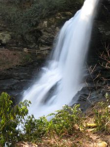
Western Carolina’s Outdoor Recreation Class Project
 In the fall of 2006, students in PRM 433, Outdoor Recreation, researched recreational opportunities in western North Carolina. They were asked to explore an aspect of outdoor recreation in western North Carolina. They divided into four groups and off they went, exploring the regions fine recreational opportunities. The following pages are the results of their work.
FISHING
INTRODUCTION/HISTORY
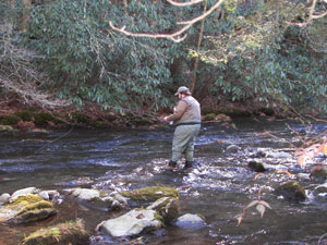 From ancient times to the present, fishing has played a huge role in the development of the area and culture. As an easily accessible source of a tasty, high protein food, fishing was no doubt one of the best ways to nourish one’s self and family; as it has been for thousands of years. Abundant natural resources were one among many reasons for residing in this spectacular land. Native Americans were the first to inhabit the area.
Equipment
 In the Cullowhee area there are two types of fishing: fly fishing and bait casting. These are two very different techniques and require different gear in order to fish properly.
Fly fishing is the art of mimicking an aquatic insect or bait fish with the use of an artificial lure that is tied with synthetic materials and often animal hair and feathers. This is done by a fly rod and reel with a specific type of line that allows for the often weightless lure to be thrown great distances. Fly fishing also requires a fly fishing rod and reel that is made for the fly line. These three items are crucial for fly fishing. Some further gear that would be needed for fly fishing is leader. Leader is a clear fishing line that attaches the fly to the fly line. This is important because fly line is colored and the fish can see it.
Bait casting also uses a rod and reel but not ones that are specifically for fly line. Bait casting uses a clear or only slightly colored line that attaches the rod and reel to a hook with bait or an artificial lure that mimics a certain part of a fish’s diet. Equipment needed for bait cast fishing is a rod and reel along with line and hooks or artificial bait. If you go with hooks don’t forget the bait that ranges from bait fish to worms and crickets in the Cullowhee area.
In order to enjoy yourself there are other things that you will need that are good for both types of fishing. The most important is a set of waders. The water in western North Carolina can be cold even in the warm summer months. Waders will keep you dry while helping to lower your chances of hypothermia. A good pair of wading boots will also help keep you on your feet and not taking a swim. These boots often have a felt bottom on them that allows you to gain extra grip on slick rocks. You will also need a place to keep all your gear and bait so a fishing vest is often a great way to keep you organized on the river.
Keep in mind that this is a minimalist list and that this is all you really need to catch fish. A great deal of money can be spent on gear if you want to make that commitment to the sport. But you can have just as much fun with a twenty dollar rod as with a two hundred dollar rod.
Regulations and Dam Release
 North Carolina Wildlife Resources Commission
DAM RELEASE
Dam release schedules are a very important part of fishing in streams and tributaries. The level of water can directly affect the quality of fishing as well as other safety concerns. Some issues involved with safety include drowning and injury by being swept into objects. Dam release schedules can be found online for this surrounding area.
Duke Energy Dam Release Schedules
Scenic Whitewater Locations
Tuckaseegee River

Directions: Take 107N towards Sylva, after passing the intersection of Old Cullowhee Road and HWY 107, take an immediate left on South River Road . From Cullowhee, this is approximately a five minute drive. After turning onto South River Road there will be multiple gravel pull-offs on the left side of the road. Any of these pull-offs will provide easy access to wade the river. At the end of South River road take a right and another immediate left onto North River Road . When you approach the water treatment plant on the right you start to see gravel pull-offs again on the your left. These are very similar to South River Road . Be wary of private property signs; for the most part the delayed harvest section will be marked with a triangular sign specifying the rules and regulations. The drive is approximately three miles from the center of campus.
Description: Anglers in the delayed section of the Tuckaseegee River will generally have no problem catching Rainbow, Brown, and Brook trout. Pay particular attention to the water levels that are subject to rise rapidly without warning from the release of the dam. Fishing is better at lower water levels
Nantahala River

Directions: Take 107N to 23/74W, follow until road splits after SCC Swain campus, stay straight bearing left towards Nantahala Outdoor Center, after passing NOC, continue to commercial put in for the Nantahala River (signs point left for Nantahala School, Duke Power). After passing the put in continue up the road approximately a quarter of a mile and look for pull-offs on your right and left continuing up to the “Cascades.” Any of these pull-offs will provide productive fishing with similar outcomes of the Tuckaseegee. Driving time is from forty-five minutes to one hour (bottom of delayed harvest).
Description: This river is best to approach with the intentions of wading with a fly rod, although, fish can be caught with a spinner rod. The Nantahala River is generally a lot colder than the Tuckaseegee so be prepared. Follow the same suggestions for lure selection of the Tuckaseegee.
Other Locations
- Little Tennessee River-Smallmouth & Trout
- Deep Creek- trout
- Oconoluftee River- Smallmouth & Trout
- Caney Fork Creek- Trout
- Panthertown Creek- Trout
- Ellijay Creek- Trout
Biographies
Phillip Patton is currently seeking his bachelor’s degree in Parks and Recreation Management (PRM). As Vice President of the PRM Club, he has been a part of many club affairs. He will be working at Seabrook Island Club in Charleston, SC fulfilling his Capstone Internship. He will also be attending GMIT in Ireland, studying Outdoor Leadership Fall ’07-Spring ’08.
Bryan Cagle is currently pursuing a bachelor’s degree in Parks and Recreation Management (PRM) with a concentration on community recreation. He fly fishes as well as bait fishes for trout, bass, walleye, brim and catfish. He fishes the waters of the Tuckaseegee, Little Tennessee, Nantahala, and their tributaries. He also fishes the waters in the Great Smoky Mounatins National Park, and the Pisgah and Nantahala National Forests.
HIKING
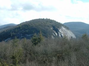 INTRODUCTION
Being involved in the outdoors seems to come naturally to some living in Western North Carolina. It has been apart of many people’s lives for a long time. Having one of the most prestigious hiking trails, the Appalachian Trail, travel through the mountains of North Carolina encourages many to get out there and go hiking just to say they have been on one trail. There are many other hiking trails within an hours drive of WCU.
HISTORY AND ORGANIZATIONS
It’s hard to give a history on hiking because it has been going on so long. Walking at any great distance can be considered as hiking, though we tend to limit that definition to being a walk or march over a great distance through rural areas, for pleasure, exercise, military training, or the like.
There is however, some history of the clubs and organizations that have been started by those who enjoy hiking in the great outdoors, such as the Carolina Mountain Club (CMC) which was started in 1923 as a spin-off of an earlier outdoor club. It was the Southern Chapter of the Appalachian Club, which chiefly focused on maintaining cabins in the White Mountains of New Hampshire for the use of its members.
The CMC, in 1931, was strengthened when it united with the Carolina Appalachian Trail Club that was founded in 1930 to complete sections of the Appalachian Trail (A.T.) in the NC and TN regions. At that time they had about 60 members with 25-30 active. If you’d like to know more visit www.carolinamtnclub.com
Another great area to research the history of hiking is to learn about the great A.T. (Appalachian Trail). Benton MacKaye was the first to visualize the long distance, multi-state trail in 1921. At that time it was part of project in regional planning; a proposal by MacKaye for a network of work camps and communities in the mountains that would be linked together by one trail that would run from the highest point in New England to the highest point in the South. To learn more about the A.T. go to www.appalachiantrail.org
One last great resource for examining the history of hiking and the men and women involved is to watch a DVD called “Mystery of George Masa.” George Masa was a Japanese immigrant whose hiking, exploration, and photography was instrumental in the founding of the Great Smoky Mountains National Park and the mapping and building of the Appalachian Trail during the 1920’s and 30’s. You can purchase this remarkable DVD at www.bonesteelfilms.com/masa.html
Hiking Trail Information
Whiteside Mountain
Travel time: 45 to 50 minutes depending on traffic.
Trail Characteristics: Easy 2 mile loop along the Eastern Continental Divide to 4,930 ft and highest vertical drop (750 ft) in Eastern US. Be very careful of the drop-offs.
Trail Directions: At trail head, trail splits. Take the right side of the split for a strenuous hike to take the left side split for a moderate hike.
Rating: 9 out of 10. This trail offers something for everyone. Take one route for a strenuous hike or take the alternate route for a moderate hike. Very pretty views. Likely to see local wildlife and birds.
WARNING: This trail has sudden drop-offs with vertical cliffs of more than 500 feet.
Panthertown Trails
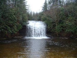 Directions: From campus, turn left onto 107 towards Cashiers. At main light (US 64) turn left. Travel 1.8 miles and turn on Cedar Creek Road (SR 1120) on left. Take Cedar Creek Road 2.3 miles to Breedlove Road on right. Take Breedlove Road 3.5 miles to Forest Service Gate.
Travel time: Between 55 minutes to 1 hour and 5 minutes, depending on weather and traffic.
Trail Characteristic: Depending on the route you choose, trails range from easy to strenuous. Offers great views and spectacular overlooks. Stop by the WCU bookstore to purchase a map of Panthertown before hiking to ensure directions.
Trail Directions: At Salt Rock Gap trail head, follow the main trail until the trail splits. This is a very dangerous part of Panthertown due to ease of getting lost. Follow a map closely and bring someone who has experience in hiking.
Rating: 10 out of 10. Panthertown offers much more then most people think. With its breath taking views, ease of travel directions and the all around atmosphere of Panthertown, this is by far the best place to hike near WCU.
Pinnacle Park
Travel Time: Approximately 15 minutes.
Trail Characteristic: 3-4 hrs., 6-7 miles of strenuous unmarked trail, up hill most of the way to the Pinnacle, downhill on the return, with a spectacular 270 degree view of Cullowhee, Webster, and Sylva from the pinnacle (beware of sharp drop off)
Trail Directions: Hike straight up the trail behind the iron gate. Stay on the main trail, and cross creek twice early on. After an hour or so, cross numerous feeder streams and pass cascading waterfall on left. 5- 10 minutes after the waterfall, take the trail to the left. Trail bears left again at a small clearing on Pinnacle Ridge leading out to overlook.
Rating: 7 out of 10. The view is gorgeous. For the experienced hiker, this trail is not bad. For the inexperienced hiker this trail can be difficult.
Waterrock Knob
 Directions: From Sylva (Exit 85) drive east on US 23/74 for 8.9 miles, turn left, enter the Blue Ridge Parkway, proceed in direction of Great Smoky Mountain National Park, go 0.8 miles past Milepost 450, turn right into Waterrock Knob parking area.
Travel Time: Between 30 and 40 minutes
Trail Characteristics: 2.4 miles round trip. Fairly steep hiking to 6,292 foot peak. Extraordinary view of the Smoky Mountains along trail and at summit.
Directions: Trail begins at right rear corner of parking lot and is paved at start.
Rating: 8 out of 10. Very difficult trial to hike, however, the view of the Smoky Mountains is breath-taking.
Mountain-To-Sea Trail
Travel Time: Between 25 and 30 minutes.
Trail Characteristics: This trail offers many access points all across North Carolina starting in Western mountains and continuing to the coast. This particular section of trail offers an easy refreshing hike. Hiking distance can be determined by the hiker; however, no more then 3 to 4 miles are suggested because of strenuous conditions beyond the 4 mile marker.
Trail Directions: Follow signage on the trail. Easy access at the Balsam Ranger Station.
Rating: 5 out of 10. Pretty, easy access, but a little challenging later in the hike. There is no return loop making the hiker back track along the same trail.
Richland Balsam
Travel Time: 30 to 45 minutes
Trail Characteristics: 1.5 miles loop to 6,410 ft summit, highest in Balsam Mountains and among loftiest in eastern US. Cool, refreshing hike through a remnant spruce-fir forest.
Trail Directions: Trail begins at left rear corner of parking lot and is paved at start.
Rating: 6 out of 10. The trail offers great views of the Smoky Mountains and the Blue Ridge Parkway. The drive is somewhat long, but the views and smells of the spruce forest certainly makes up for this.
Devils Courthouse
Travel Time: 30 to 45 miles
Trail Characteristics: 0.8 mi, round trip, paved but steep to the top of rock promontory with a great panoramic view.
Trail Directions: Take sidewalk to the East along the Parkway, turn right into woods just before tunnel. Trail is paved at the start.
Rating: 7 out of 10. Although the trail is paved, it offers a steep and strenuous hike with beautiful sights and sounds of the area.
Graveyard Fields
Travel time: Between 30 and 40 minutes.
Trail Characteristics: 0.3 mile easy trail to first waterfall or 2.3 mile roundtrip (easy to moderate) along stream to two waterfalls.
Trail Directions: Go past first stairway. The trail is easy to maneuver and offers breath taking views of two separate water falls. Bring water shoes and spend some time in the crisp mountain stream that runs alongside the trail.
The Appalachian Trail-Max Patch Area
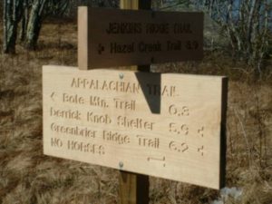 Directions: From Campus take US 23/74 to I-40. Take I-40 toward Knoxville, TN. Get off exit 7 the Harmons Den. Turn right at the bottom of exit ramp and follow a well- maintained dirt road uphill for six miles to the parking area on the right.
Travel time: Around 40 minutes
Trail Characteristics: The treeless summit of Max Patch offers a 360- degree view of the tallest mountains east of the Rockies. The Appalachian Trail extends from Georgia to Maine, it covers over 2,174 miles. The trail follows the crest of the Smoky Mountains for 88.1 miles. There are many access points for single or muli- day hikes. Another access point is located at the Nantahala Outdoor Center in Wesser, NC.
Rating: 9 out of 10. Max Patch is a great place to fly a kite, walk a dog, and is also great for night hiking.
Biographies
Amanda received her Bachelor of Science in Parks in Recreation Management, with a concentration in Commercial Recreation, in May of 2007. She was raised in Kinston, North Carolina. Harper has been hiking since she was four. She fell in love with the outdoors while a Girl Scout.
 Katie Hughs
Katie received her Bachelor of Science in Parks in Recreation Management with a concentration in Community Recreation, in May of 2007. She was born in Shelby, North Carolina. Hughes has been hiking since she as old enough to walk.
 Bryan Mangum
Bryan will be receiving his Bachelor of Science in Parks in Recreation Management in Summer Camp Programming, in May 2009. He was born in Scottsdale, Arizona. Mangum has been hiking since he was eight years old.
PADDLING
 INTRODUCTION
Western Carolina is uniquely located near a number of rivers that are excellent for paddling. There are many opportunities for beginners to expert paddlers. A number of rivers offer commercial guided raft tours and paddling instruction. The difficulty levels of these rivers range from class one to over class five. On this website you can find information on some of the class 1 to 4 rivers within an hour’s drive of Western Caroline University. They are the Nantahala, Tuckaseegee Gorge, Tuckaseegee above WCU, Slab and Eternity Hole, the North Fork of the French Broad, and the Oconaluftee.
HISTORY OF WHITEWATER IN THE WESTERN NORTH CAROLINA AREA
- 1942 Dam built by Nantahala Power and Light Company; water releases were unpredictable
- 1954 American Whitewater founded.
- 1971 Public use of the Nantahala River was assured when Percy Ferebee donated 5,000 acres to the US Forest Service.
- 1972 first year whitewater slalom featured as an Olympic event.
- 1972 Nantahala Outdoor Center (NOC) founded by Payson Kennedy and Horace Holden; Nantahala River became an Olympic Training Center
- 1981 90,000 users per year
- 1983 regular water releases
- Today there are over 200,000 users per year on the Nantahala River
WHITEWATER SCENIC LOCATIONS
Nantahala River
Directions: From campus turn right onto 107N for 5.8 miles. Turn right onto US 23 for 0.6 miles then merge onto 74 west for 35 miles to the NOC. The public put-in is approximately 9 miles and the take-out is 8 miles downstream on your right about 100 yards from Nantahala Falls .
North Fork of the French Broad
Directions: From the front of campus, turn onto 107 S, go 7 miles then take a left onto Canada Rd. Continue for about 10 miles. Take a left on Charlie’s Creek Rd. Continue until road T’s. Take a right on Hwy 215. Go about 15 miles until you get to Alligator Rock. Parking for the take out is across the street. To find the put in head back up 215 for about 3 miles and park on the left in a right bend at a couple of dirt lumps and a puddle. Follow the trail down to the river.
The Oconaluftee River
Directions: From campus turn right onto 107N for 5.8 miles. Turn right onto US 23 for 0.6 miles then merge onto 74 West for 11 miles to exit 74, Highway 441N. Go about 5 miles and take a left on Stacey Saunooke Dr . Take a left when this comes to a stop at another road. The put-in is under the bridge. To find the take-out, head back to 441N. Take a left at the T. Go about 2.5 miles to the take-out on the left. You can also take out at any of the pull offs on the left side of the road.
The Tuckaseegee River
Directions: From campus, turn right onto 107N. Go 8 miles and take a left onto US 441 and as soon as you cross the bridge, take an immediate left onto North River Road . Take an immediate left for the public put-in. The take out is 6 miles downstream on your left at the first bridge across from Tuckaseegee Outfitters.
Tuckaseegee above WCU
Slab and Eternity Holes
Directions: From the front of campus, turn onto 107S, go 7 miles then take a left onto Shook Cover Road . Continue for one mile and there will be a turn off and the trail to the Slab is on your left.
Online Resources
Biographies
I am a Parks and Recreation student who graduated in August 2007. I have spent a lot of time on the water: rafting on the Nantahala, Ocoee, and Lower New River, and canoeing and kayaking on flat-water rivers and lakes.
 My name is Todd Henry.
I am a Parks and Recreation student who graduatde in May 2007. I started whitewater recreation sports in the summer of 2001. For five summers, I have been a raft guide in Colorado . Since I started paddling, I have kayaked in 15 states.
 My name is Steve Page.
I am a Parks and Recreation student scheduled to graduate in August 2009. I started whitewater recreation sports in the summer of 2005. I have traveled all over the southeast United States and Costa Rica in search of whitewater.
 My name is David Johnson.
I am a Parks and Recreation student scheduled to graduate in May 2008. I enjoy many recreational activities including whitewater and team sports. I plan on working in a collegiate athletic program after graduation.
VIEWING WATERFALLS
INTRODUCTION
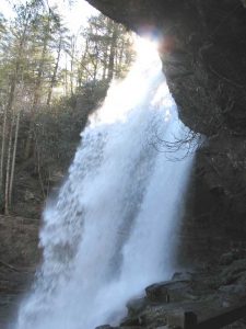
Western North Carolina has an abundance of waterfalls, that attract visitors to the region. In correlation to the Western Carolina University campus, there are numerous waterfalls within an hours drive. Many of these waterfalls you might have to walk anywhere from .3 miles to 2 ½ miles to enjoy the beauty and scenery they offer. Others in the area are right off the road and you can park and view these waterfalls.
 HISTORY
There is an abundance of waterfalls in the Western North Carolina area that provide a glimpse into the geologic history of the area. The volcanic and earthquake activity that occured in the area some 600-700 million years ago provide us with these breathtaking scenic mountains and the many picturesque waterfalls. In 1912 Transylvania County became known as the “Land of Waterfalls” and is home to over 250 waterfalls including Whitewater falls which is considered to be the highest waterfall east of the Rockies. Waterfalls in Western North Carolina have been popular tourist attractions for more than 100 years.
WATERFALL LOCATIONS
Bridal Veil Falls
Directions: Turn left onto 107 South towards Cashiers. Follow to red light in crossroads of town. Take a right at light and follow Highway 64 to Highlands. Turn right onto 64/28 towards Franklin follow this road for 2.5 miles where you will see Bridal Veil Falls on your right.
Dry Falls
Dry Falls is less than one mile west of Bridal Veil Falls , both are handicap accessible. The falls are on the left, and you may take the first or second turn into the parking lot. Dry Falls is also located on the Cullasaja River , you can walk underneath the 80 foot falls, and the path is approximately 30 feet below the top of the falls.
Directions: Turn let onto 107 South towards Cashiers. Follow to red light in crossroads of town. Take a right at light and follow Highway 64 to Highlands. Turn right onto 64/28 in Highlands towards Franklin follow this road for 3.5 miles where you will see a sign for the Dry Falls parking area.
Looking Glass
Looking Glass Falls is 30 feet wide and 60 feet high. Looking Glass gets its name; when the falls freeze, the sunlight on the surface reflects what resembles a looking glass.
Moore Cove Falls
Directions: Turn left on highway 107 South. At light, turn left onto Highway 64 towards Brevard. Continue past Looking Glass Falls, until you come to a stone bridge, park on the right before the bridge. Entrance to trail is located at beginning of bridge.
Silver Run Falls
Directions:From U.S. 64 in Cashiers, drive south on N.C. 107 for approximately 4 miles where you will see a pullout on the left side of the road in which you can park. There is an obvious trail at the end of the pullout that will lead you down to a footbridge. The base of the falls is a short distance beyond the footbridge.
Turtleback Falls
Directions: Turn left on highway 107 South. Take a left at light onto Highway 64. Take right onto 281 (Amoco station on your right) follow to Gorges State Park. Park in the parking lot, and walk to the trailhead at the top of the entrance.
Whitewater Falls
Directions: Turn left onto 107 South; continue on through the stop light. In South Carolina; take left on to HIghway 281 toward Salem, when you get to the stop sign follow signs to Whitewater Falls.
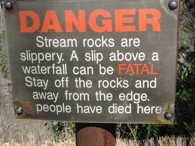
Whether you are going on your own or with a group always take caution when viewing waterfalls especially in the winter months when the falls could freeze and make for dangerous footing. Please follow posted warning signs and use caution.
Biographies
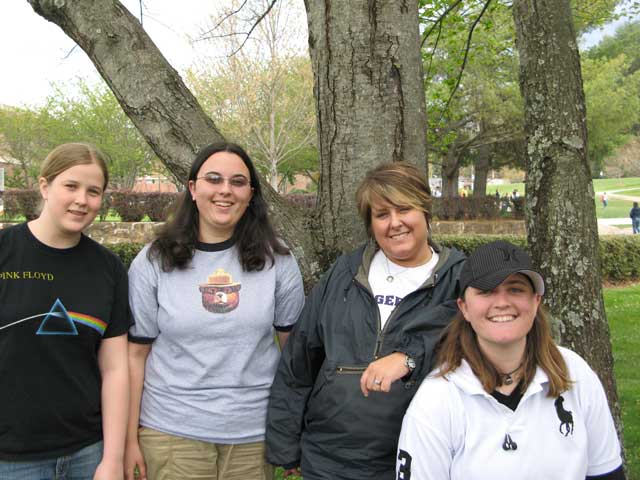
L to R: Amy Boswell, Deana Blevins, Tameka Buchanan, Leigh L. Whaley
Tameka Buchanan– As a lifelong resident of Jackson County, I have seen many changes throughout the years. One of the things that has remained the same is the scenic beauty that surrounds us, here in Western North Carolina. I enjoy the outdoors and everything that nature has to offer. I am a Parks and Recreation Management major with a concentration in Community Recreation, graduating in August 2008.
Leigh L. Whaley– Originally from Fayetteville North Carolina, I enojy hiking, backpacking, and camping in the North Carolina Mountains. I am a Parks and Recreation Management major with a concentration in Outdoor Leadership And Instruction, and minoring in Hospitality and Tourism, graduating in May 2008.
Deana Blevins– I am from a small rural area in Southwestern Virginia that is nestled in the heart of the Appalachian Mountains. I am a senior at Western Carolina University majoring in Parks and Recreation Management. In my spare time I enjoy backpacking, photography and playing old-time music. In the future I hope to work in a state or national park so that I can help protect the natural and historic areas of the country.
Amy Boswell– I am currently attending Western Carolina University and majoring in Parks and Recreation Management. My interests include swimming, hiking, music and dogs. I hope to one day to be an aquatics supervisor at a recreation center.

